
All Blogs articles

Picture of a hulk on the shore side of the Faversham Creek. Source Coasts in Mind/MOLA
In this week's blog, we focus on some of the intertidal features and archaeological monuments that can be found in the intertidal zone of the Swale. Despite not being as visually impressive as historical buildings in the surrounding area, some monuments that exist around the shoreline of the estuary are intertidal gems and represent some unique aspects of the area's history and a window into the intertidal past of the Swale. Beyond their historic value, these archaeological monuments bear witness to how our coastal heritage is being affected by climate change. Climate change will not only strip communities of their cultural heritage and damage the environmental and physical landscape, but it also represents a significant cost to the local economy. At a local and governmental level, the costs include the need for sea defences, the loss of income and the gradual depopulation of coastal areas.
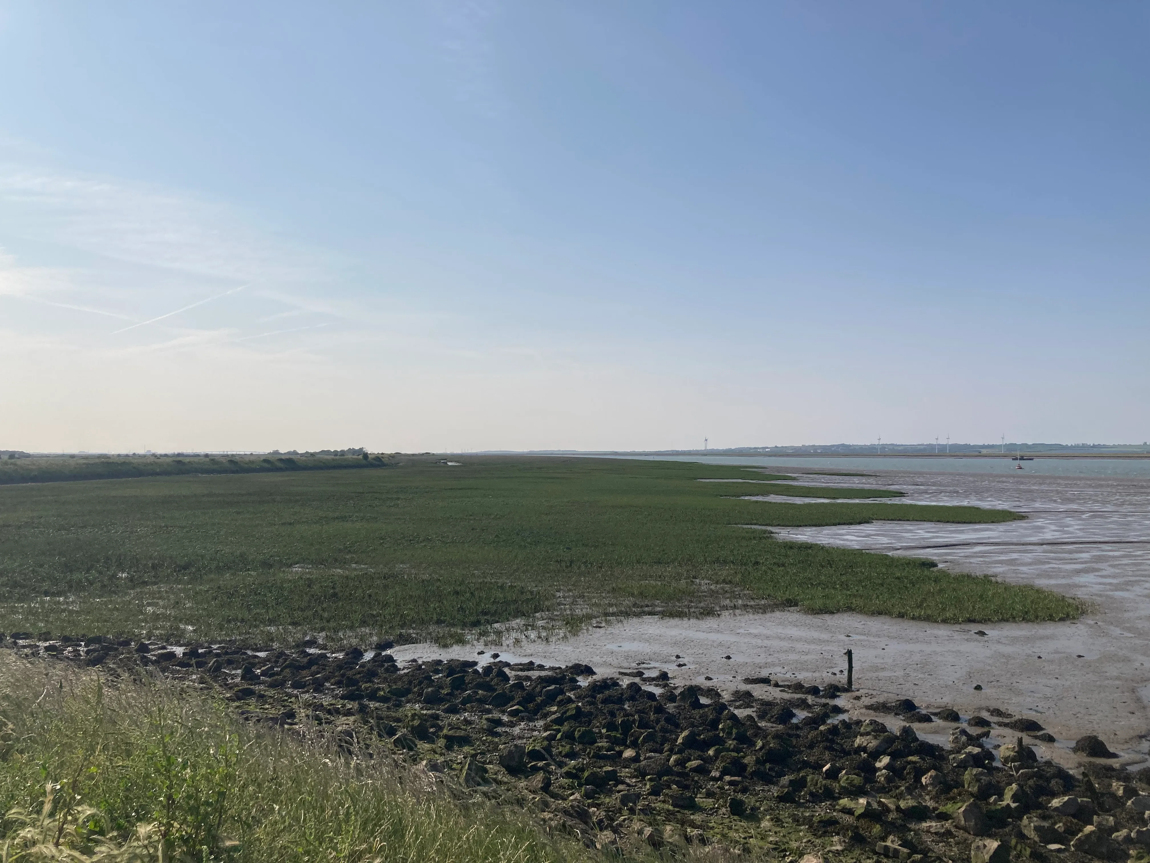
The Swale has 79.3 km of coastline, 3822.9 area of basin (Ha), with an intertidal area (Ha) 2670. Just to put that in perspective in football terms, that’s somewhere between 3000 to 4000 football pitches of intertidal zone space. The Swale is a temporary and transient landscape that has transformed as a result of the weather, the currents and tides on a bi-daily basis, with its own intertidal landscape of plateaus and gullies, mud flats and exposed rocks shaped by millions of years of geology.

The area of coast that CiM covers, as shown on our mapping platform. Source Humap
The archaeological profile of the Swale is one of the richest in the country, with archaeological features that include intertidal remains of prehistoric droveways, Roman pottery, and salt-working sites, as well as huge early medieval fish traps. The Isle of Sheppey boasts archaeological significance ranging from the probable site of a 16th century Artillery Bulwark (to defend Henry VIII’s fleet in the Medway), as well as the 17th century Sheerness Dockyard and Bernard De Gnomes fortifications, and installations from both World Wars. A huge range of exciting archaeology! All of which have been heavily impacted by coastal development and erosion in recent decades. You can read a little more about this coastal change at Warden Point on our blog here.
The anaerobic (absence of free oxygen) environment of the mud and clay of the estuary has helped to preserve the archaeological record, continuing to reveal secrets of this changing foreshore. Tide and current deposition from freshwater sources, coupled with sediment accumulation, have formed entire landscapes of features that are relatively recent and may not accurately reflect the long-term cultural heritage composition of the area. These sediment coverings can have both positive effects, with some structures being preserved due to a lack of current and exposure to anaerobic conditions (absence of free oxygen). However, it can also be negative, and create huge amounts of overburden (the build up of silt or soil above something), which causes structures to collapse or be completely submerged and become invisible. This results in their loss from the archaeological record, making them more challenging to assess.
The intertidal zone of the Swale estuary was at the centre of human activity, vital for fishing, shipping and trade. Throughout its history, humans have used it as a source of food, for transport and for the extraction of materials ranging from fish and shellfish to salt and chemical production. With the growth of intertidal archaeology in recent decades, more and more aspects of the maritime cultural landscape have come to light. Many features of the intertidal landscape became part of the wider trend of research linking the terrestrial and underwater aspects of activity.
The Kent coastline has a range of intertidal shipwrecks and historical ports that have been active in some cases for thousands of years, such as the Roman 'Pudding Pan wreck’ dating to the mid to late 1st century AD, and the mid to late 2nd century AD. With later wrecks, such as the intertidal Wreck at Tankerton Beach, Kent, dated to a 16th-century or early 17th-century small or medium-sized merchant ship. Shipwrecks are time capsules that reveal parts of past social and economic history. In many cases, they appear and disappear with the shifting of sediment across the intertidal zone. However, shipwrecks are some of the most fragile structures, being susceptible to storms, erosion and the ecological impact of exposure, such as shipworms. We need to conserve them.

The remains of a wooden wreck on Tankerton Beach. Source CITiZAN/MOLA
One of the most interesting structures in terms of human activity and ecological change on the intertidal zone are its wooden fish traps. These have been built over centuries to take advantage of the current and tide at the time they were built (which may be different to today!), as well as the migration of fish species up and down the estuary. They’ve been part of the maritime cultural landscape of the United Kingdom since at least the Mesolithic period and found their heyday during the medieval and early post-medieval periods. Despite not being used in some cases for hundreds of years, fish traps are part of the modern local maritime landscape with their own local folklore and traditions.

Depiction of the "Pollard" is the area of intertidal mudflats at Seasalter - This section of the Tudor strip map shows a sequence of fish traps (kiddles) adjoining the area. Source c1514-1540 - British Library. Shelf-mark Cotton Charter XIII.12 - Image courtesy of Mark Harrison, Timescapes (imaged at British Library)

Engraving of a French fish weir from the 18th century, from Duhamel du Monceau’s Traité général des pesches (1765: 1.2 pl. 24)
There are upwards of nine different fish trap locations in the Swale Estuary, identified in the Kent Historic Environment Record (HER). With many more fish trap sites known to the local communities, who have been using the tidal flats for centuries for shellfish gathering and fishing. The most common form of weir (a term derived from `were' - an Anglo-Saxon word meaning fish trap) is a simple V-shaped one, but they can come in other shapes adapted to the local geography.

Map showing the locations of fish trap sites (red dots) in the Kent Historic Environment Record
The kind of information that can be derived from a fish trap can tell us not only about people who used these structures but also the environment in which they were constructed. The fish trap locations reveal changes to the local shoreline and currents over time; their structures can tell us about local wood types and practices used to gather and process the wood used in the structure. Their interaction with the local environment can also give us insights into the local ecology and fish species.
From the air, these structures, when visible, would appear to be a large view formed of two arms or a wall of piles with wooden panels running together to a single point. Woven baskets or nets would be placed at the point of the `V', which would normally be oriented to the receding tide or current that pushed the fish into the trap. Though not the most spectacular structure when seen on the tidal flats, fish traps represent a culmination of a past community’s work and a large amount of time and energy to keep them functioning on a day-to-day basis. A monument of sorts to the people of the intertidal past!
Despite intertidal archaeology being just one component in the wider area of research of the Coasts in Mind (CIM) project, it is in the firing line in terms of its vulnerability to climate change and storms, which will affect the wider coastline in the coming decades. In its unique context, it preserves some of the earliest human activities in this landscape and can give us a deeper insight into how people in the past have adapted to change and interacted with the world around them. Only by highlighting the value of this archaeological landscape can it be hoped to encourage its conservation and study for future generations.
Relevant sources
Bannerman, N. and Jones, C., 1999. Fish‐trap types: a component of the maritime cultural landscape. International Journal of Nautical Archaeology, 28(1), pp.70-84
Kent Historic Environment Record (HER)
Murphy, P., 2010. The landscape and economy of the Anglo-Saxon coast: new archaeological evidence. The Landscape Archaeology of Anglo-Saxon England. Woodbridge: Boydell, pp.211-222
Paddenberg, D. and Hession, B., 2008. Underwater archaeology on foot: a systematic, rapid foreshore survey on the North Kent Coast, England. International Journal of Nautical Archaeology, 37(1), pp.142-152
Redknap, M., 2015. Observations on Roman Pottery from Pudding Pan and the Thames Estuary and Early Surveys. Britannia, 46, pp.15-36